



Site Geological Study
Geo Costa Rica prepares site geological studies to identify and interpret the materials, landforms and geological conditions that characterize a property and may be relevant to a development project.
Geological characterization can also provide information on the physical environment for environmental assessment processes and SETENA submissions when required by the project's characteristics.
Understand site geology before making decisions
A Site Geological Study seeks to understand the composition of a site, how its materials relate to the terrain and which conditions may be relevant to the project.
Turn field evidence into a geological interpretation
Geological maps can indicate which units occur in a region, but a site study relates that information to the property's specific conditions.
We analyze materials, landforms, previous information and observed evidence to understand the site's geological setting and identify aspects to consider in subsequent project stages.
The objective is not to describe rocks in isolation, but to explain the geological conditions present at the site and their potential significance for the project.
We analyze the conditions that explain the geological composition of the site
We integrate geology, geomorphology and territorial context to develop a coherent understanding of the property.
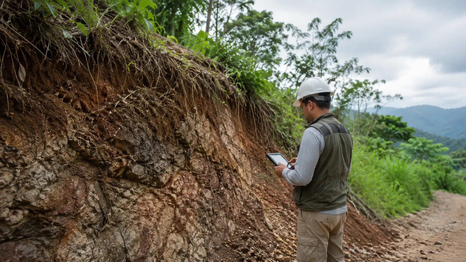
Site Materials and Geological Units
We identify rocks, superficial deposits, weathered materials, contacts and other evidence to characterize the site's geology.
Relief and Landforms
We examine slopes, hillsides, terraces, valleys and other features that help explain how the terrain has evolved.
The Property Within Its Geological Setting
We relate existing maps, topography, imagery and background information to conditions observed on the property.
Maps guide the investigation; field observations make it possible to verify, refine and interpret what is actually present on the property.
From Existing Information to Site Interpretation
The investigation compares available information with evidence observed directly at the site.
Field Observations Show How Geology Is Expressed on the Ground
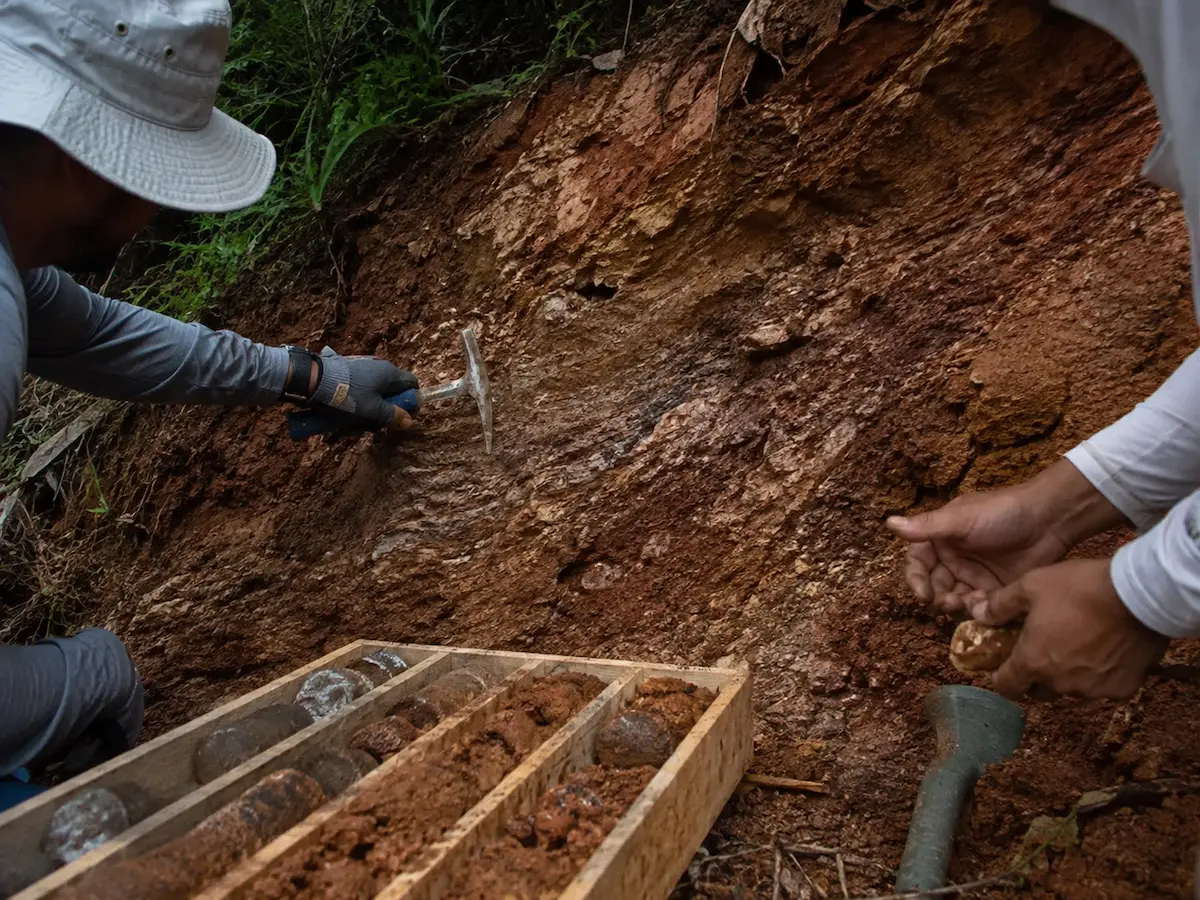
Geo Costa Rica conducts site reconnaissance to document materials, outcrops, exposed cuts, landforms and other evidence relevant to the study's objectives.
The extent of fieldwork depends on property size, accessibility, existing conditions and the technical question to be addressed.
Review
Review available maps, landforms, imagery, previous studies and site documentation.
Observe
Directly inspect materials, outcrops, exposed cuts and landforms.
Compare
Compare observed conditions with available geological and territorial information.
Interpret
Integrate the evidence into a coherent geological interpretation of the site.
From Field Evidence to a Geological Interpretation
The report organizes the evidence collected and converts it into technical information that explains the property's geological setting.
What the Study Can Provide
The final contents depend on the objective and conditions encountered at each property.
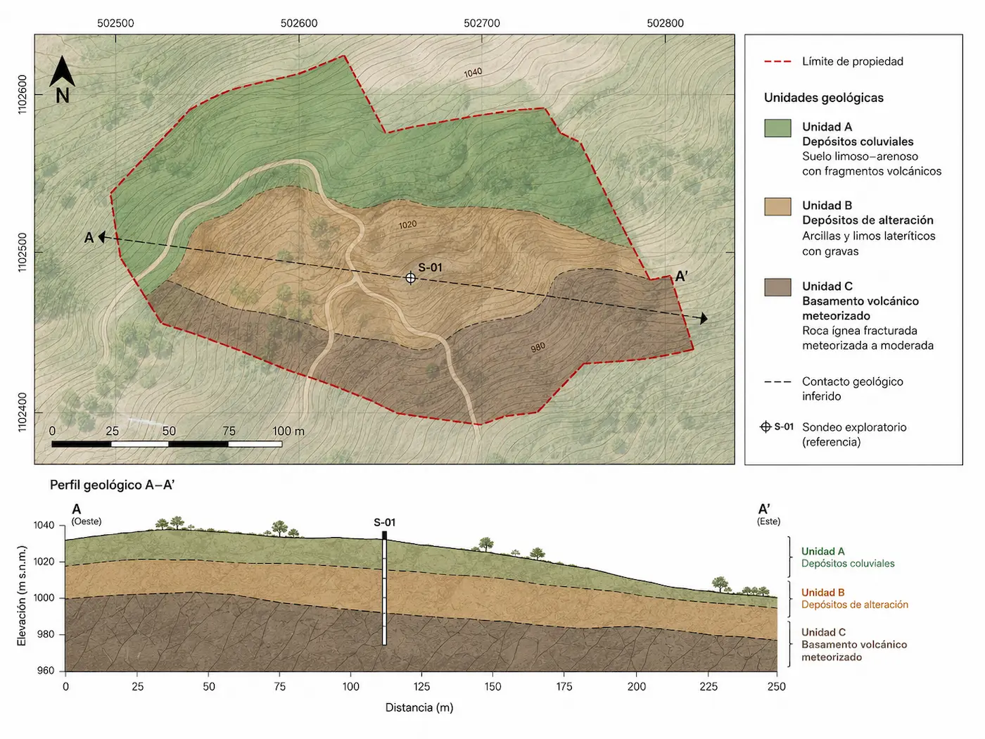
The Deliverable Is More Than a Map
A map shows where particular conditions occur, but the value of the study lies in explaining what they represent, how they relate to one another and how they help us understand the site.
When Is a Site Geological Study Useful?
The study is especially useful when a specific question about a property's geological conditions must be answered before proceeding with project decisions.
Before Development
Understand general site conditions before making particular design, location or development decisions.
When Site Conditions Raise Questions
Outcrops, exposed cuts, slopes, changes in materials, landforms and other conditions may require specific geological interpretation.
Before More Detailed Investigation
Initial characterization can help determine whether a question subsequently requires soil studies, geophysical surveys, drilling or other specialized investigation.
Site Geology in SETENA Environmental Assessment Procedures
Geological characterization documents a property's physical conditions when they are relevant to a project's environmental assessment.

Geological Characterization in Support of Environmental Documentation
Depending on the project's characteristics and location, geological materials, landforms, surface processes and other relevant physical site conditions may need to be evaluated.
A Site Geological Study brings together existing information, mapping, geomorphological analysis and field reconnaissance to interpret and document these conditions.
The Scope Depends on Project Conditions
Geology is only one component of an environmental assessment. Other technical questions must be addressed through the corresponding specialized studies.
Other Studies May Complement the Assessment
Each study addresses a different technical question and should be used when warranted by the project's particular characteristics.
Soil Studies
Assess the geotechnical properties and behavior of materials present at the site.
Hydrogeological Study
Examines aquifers, groundwater levels, subsurface flow and other relevant hydrogeological conditions.
Hydrological Study
Examines precipitation, runoff, drainage and other aspects of surface-water behavior.
Natural Hazards
Assess flooding, mass movements, faulting and other processes that could affect the project.
When a Closer Investigation Is Needed
A geological study may indicate that a condition requires investigation using specific soil or subsurface methods.
Soil Studies
Geotechnical investigation of the properties and behavior of ground materials.
Geophysics
Investigates contrasts and variations in the subsurface using geophysical methods.
Exploratory Drilling
Allows direct observation of materials at different depths and collection of subsurface samples.
Before Requesting a Site Geological Study
The scope depends on the technical question, the property's characteristics and the purpose for which geological information is needed.
Is this the same as a soil study?
No. A geological study characterizes and interprets the site's geological setting, whereas a soil study examines specific geotechnical properties and material behavior.
Is drilling always required?
No. Drilling is used when direct investigation of the subsurface is necessary and the question cannot be adequately answered from previous information, mapping, surface observations or other available evidence.
What information does Geo Costa Rica need to prepare a quote?
We can start with the property's location, the type of project and any available plans, designs, studies or technical background information.
Do you need a Basic Geology Study for SETENA?
When an environmental submission requires geological site conditions to be documented, we can prepare the corresponding geological characterization. The specific scope depends on the project characteristics and the other technical components required for the submission.
Does every project submitted to SETENA require a geological study?
Not necessarily. The technical studies to be included depend on the project type, location, site environmental conditions and the specific requirements of the submission.
Does a geological study replace hydrogeology or natural hazard assessment?
No. Geology, hydrogeology, geotechnics, hydrology and natural hazards address different technical questions. When one of these subjects is relevant to a project, it must be addressed through the appropriate specialized study.
Understand Your Site's Geological Conditions
Geo Costa Rica prepares Site Geological Studies for properties and projects throughout Costa Rica, combining map analysis, field reconnaissance and geological interpretation.