



Environmental Impact Assessment (EIA) in Costa Rica
We integrate the physical, biological and social environments, technical studies and project mapping to identify and assess environmental impacts and define the measures needed to manage them.
Understanding how a project interacts with its surroundings
An Environmental Impact Assessment examines existing conditions, planned activities and the changes a project may cause to different environmental components.
Understand the environment
We characterize relevant site and regional conditions before assessing changes that the project may produce.
Identify impacts
We link project activities to the environmental components that may be affected.
Define measures
We establish measures and indicators to prevent, mitigate, correct or compensate for impacts, as appropriate.
When might an Environmental Impact Assessment be required?
The applicable environmental assessment instrument depends on the project's characteristics, location, applicable thresholds and the significance of the impacts to be evaluated.
A single site encompasses different environmental components
The scope of the baseline assessment is defined by the project's characteristics and the environmental factors that may interact with its activities.
Land, water and natural processes
Geology, soils, landforms, surface water and groundwater, climatic conditions and relevant natural hazards.
Ecosystems, flora and fauna
Vegetation cover, habitats, species and ecological relationships potentially affected by the project.
People, activities and territory
Population, land use, nearby activities, social perceptions and the project's relationship with surrounding communities.
From project activities to their effects on the environment
We identify which actions may cause changes, which components may be affected and the environmental significance of each interaction.
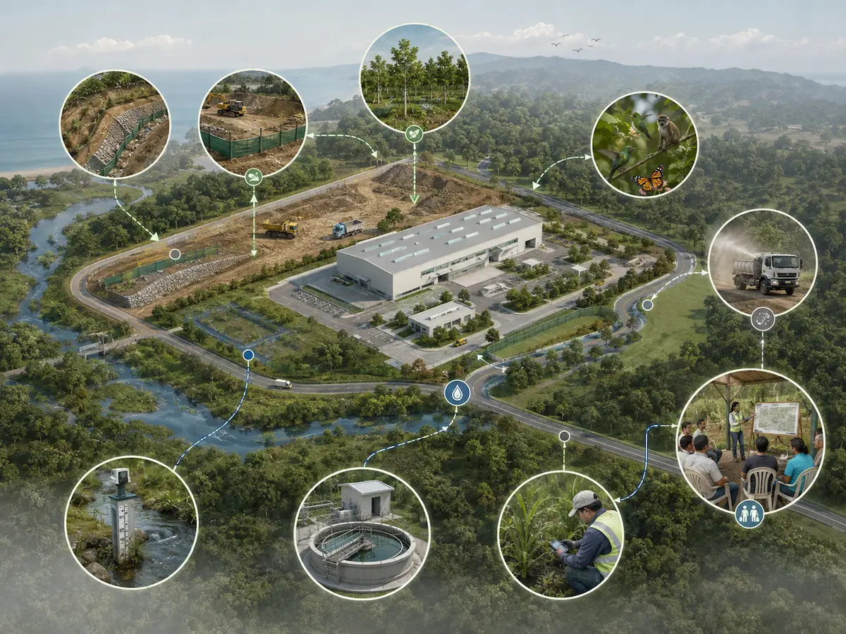
Each impact is assessed in relation to the project
Every identified impact should lead to a specific measure
Environmental measures must address the project's actual impacts and be technically compatible with its design, construction and operation.
Avoid
Change an activity or decision to prevent the impact from occurring.
Reduce
Reduce the intensity, extent, duration or likelihood of an environmental effect.
Restore
Remedy altered conditions and restore environmental functions where technically feasible.
Compensate
Establish compensatory measures where impacts remain that cannot be fully avoided or remedied.
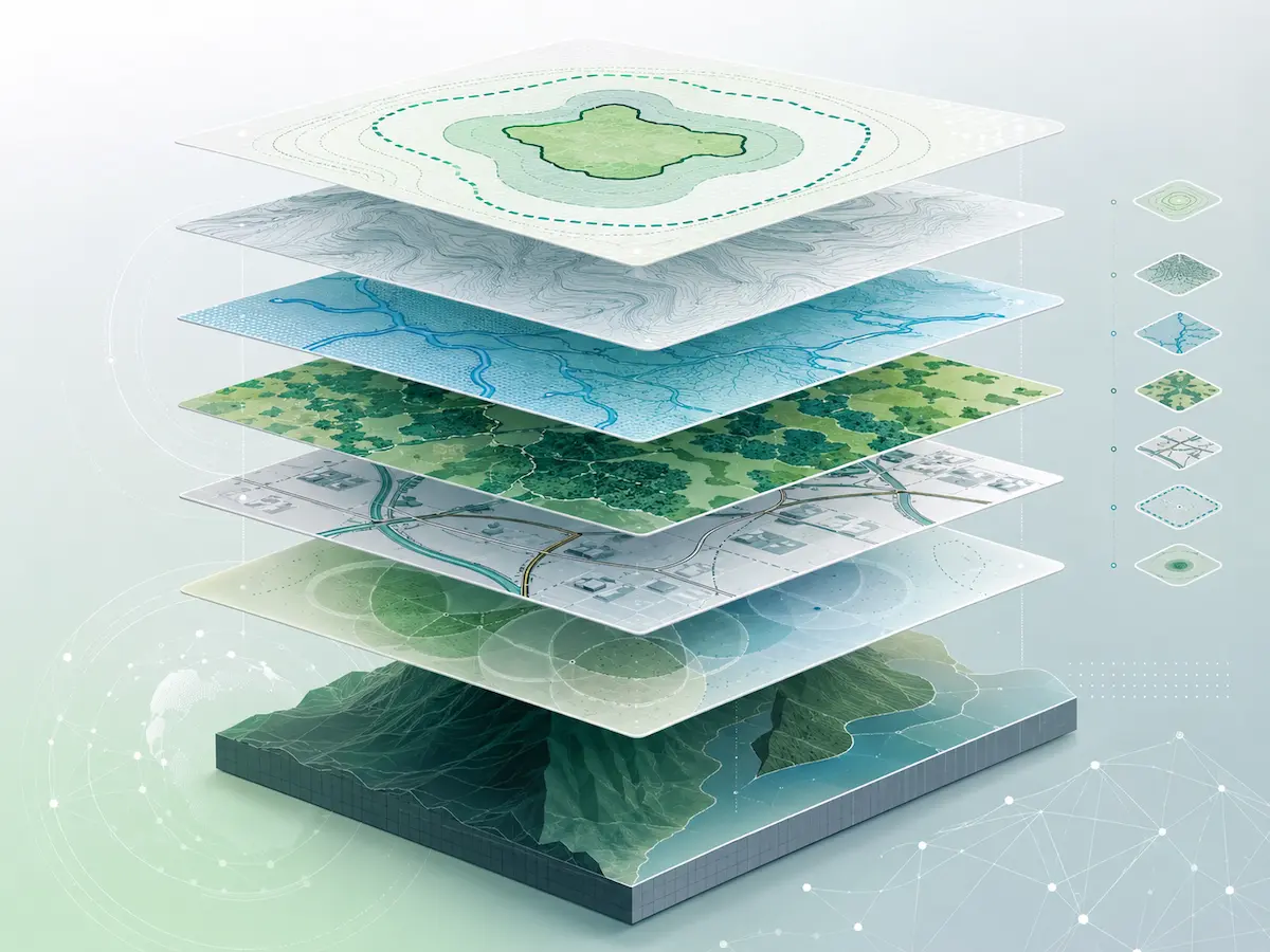
Mapping connects the project to its territory
GIS analysis spatially integrates the Project Area, its Area of Influence, environmental components, restrictions and relevant territorial relationships for impact assessment.
Different map layers answer different questions
- Project Area and infrastructure components.
- Environmental Area of Influence.
- Topography and terrain conditions.
- Hydrography and water resources.
- Vegetation cover and land use.
- Infrastructure and accessibility.
- Restrictions and protected areas.
- Environmental and social receptors.
Studies are selected according to the project's needs
Not every EIA requires the same components. Each specialized study is included when it provides information needed to characterize or evaluate an environmental interaction.
Site Geological Study
Characterization of materials, geomorphology and relevant geological conditions at the site.
Soil Studies
Properties and geotechnical behavior of materials present at the site.
Hydrogeological Study
Aquifers, groundwater levels, flow direction and relevant hydrogeological conditions.
Hydrological Study
Precipitation, runoff, drainage and hydrological behavior in the study area.
Natural Hazard Assessment
Flooding, mass movements, faulting and other processes that may constrain the project.
Biological Study
Characterization of vegetation cover, habitats, flora, fauna and ecological sensitivity.
Social Component
Analysis of population, activities, perceptions and the project's relationship with its human environment.
Archaeological Component
Assessment of archaeological heritage where required by the characteristics of the project or site.
Project Georeferencing
Project geospatial information and preparation of mapping inputs for environmental assessment.
Environmental Impact Assessment within the SETENA process
An EIA may be the applicable environmental assessment instrument within an Environmental Viability procedure using Form D1.

The technical study and the permitting procedure are distinct parts of the same process
This page describes the Environmental Impact Assessment as a multidisciplinary technical deliverable. Submission and management of the Environmental Viability application follow the corresponding procedure before SETENA.
When a project requires D1 + EIA, we coordinate the technical, professional and mapping components needed to prepare the study and environmental application.
From scope definition to an integrated study
We organize the work so that each discipline addresses a specific question and its findings can be integrated into a single environmental assessment.
Review the project
We examine its location, design, activities, background information and general site conditions.
Define the scope
We identify the environmental components and technical studies to be developed.
Collect information
We integrate background information, fieldwork, specialized studies and thematic maps.
Identify impacts
We relate planned actions to environmental components that may be affected.
Define measures
We establish the appropriate environmental measures and indicators.
Integrate the EIA
We consolidate findings, mapping, assessment matrices, measures and appendices into a coherent technical document.
A study bringing together analysis, mapping and environmental measures
Before starting an Environmental Impact Assessment
Do EIA and EsIA mean the same thing?
Both acronyms may be used in everyday Spanish to refer to the Environmental Impact Assessment study. SETENA currently uses the acronym EsIA in its documentation.
Does every project require an EIA?
No. The applicable environmental assessment instrument depends on the project's characteristics, location, thresholds and case-specific evaluation.
Does every EIA require the same studies?
No. The scope depends on environmental components potentially affected and the specific characteristics of the project.
What is the Area of Influence?
It is the geographic area where project-related interactions or impacts may occur. Its delineation must be based on environmental analysis, rather than solely on property boundaries.
Who participates in preparing the study?
Depending on the scope, specialists in geology, hydrogeology, engineering, biology, archaeology, social sciences, mapping and other relevant disciplines may participate.
Does an Environmental Impact Assessment guarantee Environmental Viability approval?
No. The EIA provides technical information for assessing the project. SETENA is responsible for the final decision.
Need an environmental assessment for your project?
We can review your project, its location and available information to define the study scope, required technical components and work strategy.
Let's review your project
Tell us what you plan to develop, where the project is located and what stage it is at.