



Rapid Archaeological Report for SETENA
We inspect the Project Area to identify archaeological evidence that should be considered before any land disturbance, documenting findings through professional assessment, mapping, and technical records.
Assess the site before land disturbance
The Rapid Archaeological Report provides an initial assessment of archaeological conditions in the Project Area through background research, site inspection, documentation, and professional interpretation.
Background information
Available information is reviewed to establish the archaeological context of the area.
Inspection
The specialist surveys and observes the site to identify surface evidence or conditions of archaeological interest.
Interpretation
Observations are evaluated together to establish conclusions and recommendations relevant to the project.
When might an archaeological review be required?
The need for a report depends on the environmental procedure, project characteristics, and the particular conditions of the proposed development site.
Buildings
Residential, commercial, industrial, and other developments involving ground disturbance.
Earthworks
Excavation, cutting, filling, grading, and other changes to the ground surface.
Linear infrastructure
Roads, access routes, pipelines, and other works extending across large areas.
D1 Form
When the SETENA procedure requires the archaeological component to be included in the environmental application.
The inspection seeks evidence directly on the site
The field survey examines the ground surface, existing cuts, exposed areas, and other conditions that may reveal archaeological evidence.
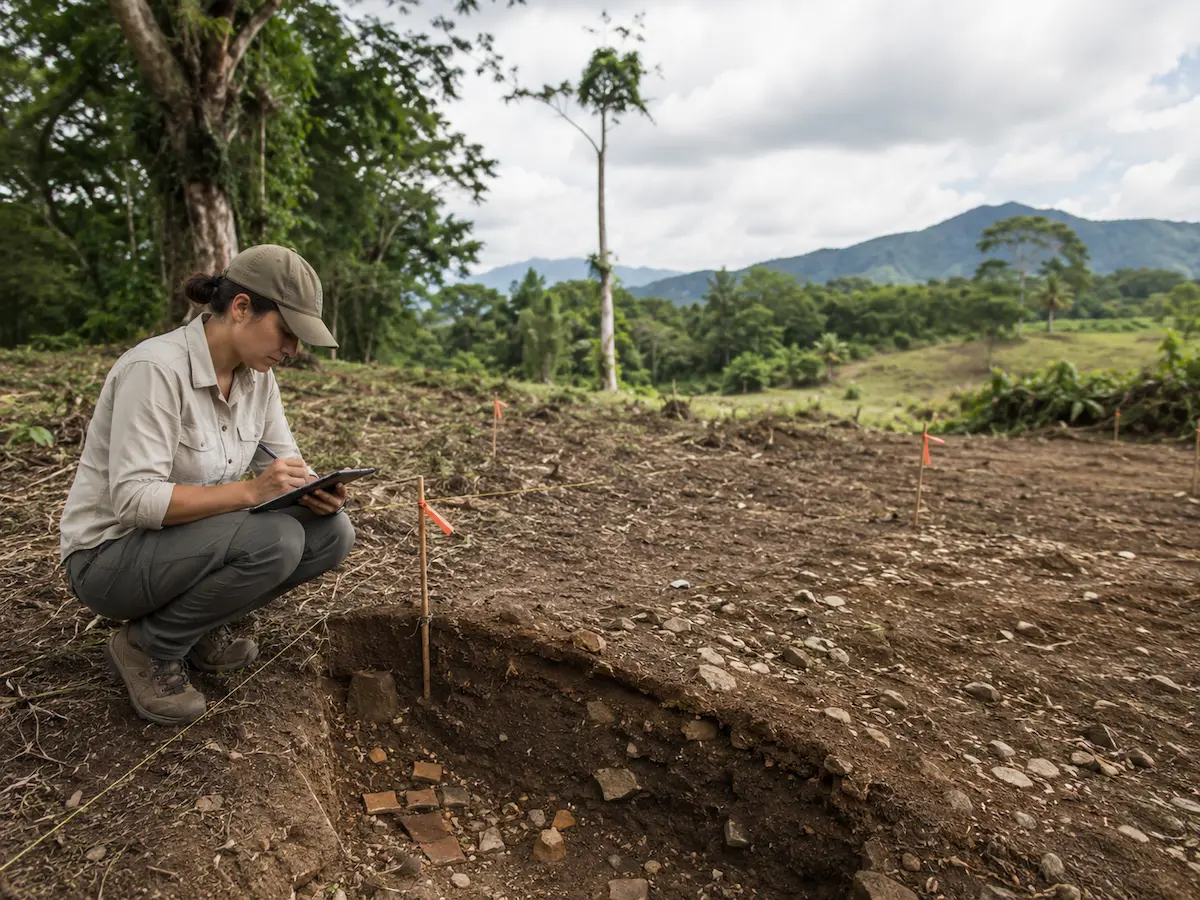
What is examined during an inspection?
- Ground surface and areas offering better visibility.
- Cuts, slopes, and places where soil is already exposed.
- Pottery fragments and other visible cultural materials.
- Stone artifacts or other traces of past human activity.
- Previous site disturbances.
- Conditions that may limit surface visibility.
- Spatial relationship between observations and the Project Area.
The inspection helps determine next steps
Field observations and available background information support a professional assessment of the area's archaeological conditions and any applicable recommendations.
Proceeding with the process
When no visible archaeological evidence is identified, the specialist documents the conditions encountered and issues the appropriate professional assessment.
Further assessment
Materials or conditions of interest may indicate the need for more detailed archaeological investigation.
Recommendations
The professional assessment may include recommendations for later project stages according to the conditions observed.
From field inspection to technical report
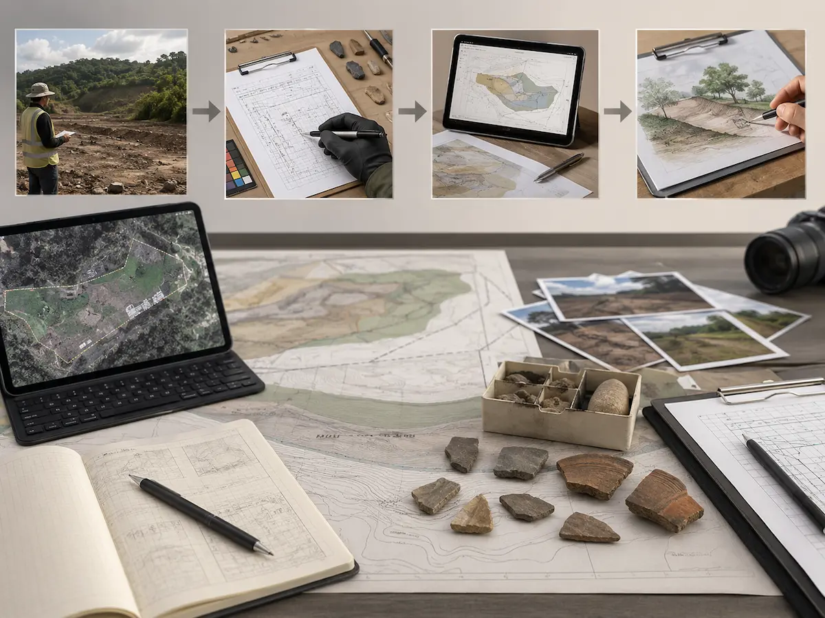
Observations become useful when they are documented, located, and interpreted in relation to the site and the proposed works.
We document what we observe and its relevance to the project
Rapid Archaeological Report under the D1 Form
SETENA includes an archaeological component among the general requirements of the D1 Form and establishes the technical and professional conditions for its submission.

Archaeological component of the environmental application
When a Rapid Archaeological Report is required, it must be prepared and signed by an appropriately qualified professional and meet the technical requirements applicable to the application.
When submission of the study is not technically required, the current procedure allows a professional justification for its omission.
What if the site requires a more detailed assessment?
The initial inspection may indicate that additional archaeological work is required before or during certain stages of the project.
Archaeological Assessment
Provides a more detailed investigation of the extent, characteristics, and context of identified archaeological evidence when further study is needed.
Archaeological Monitoring during Earthworks
Provides professional monitoring of selected ground disturbances where project archaeological conditions require observation during construction.
From project information to a documented archaeological assessment
We organize the review to connect field conditions with the location and characteristics of the proposed works.
Review the project
We examine the location, Project Area, plans, and available background information.
Plan the inspection
We identify relevant areas and conditions to organize the field survey.
Inspect the site
The specialist conducts an archaeological reconnaissance of the property.
Document findings
We record observations, photographs, and relevant spatial references.
Interpret findings
We integrate background information and evidence to establish a professional assessment.
Prepare the report
We compile results, documentation, and recommendations in the required format.
A professional assessment supported by field observations
Before requesting a Rapid Archaeological Report
Are Rapid Archaeological Report and Rapid Archaeological Study the same?
Both terms refer to a rapid archaeological assessment of the site. Current SETENA documentation uses the name Reporte Arqueológico Rápido (Rapid Archaeological Report).
Does every project require a Rapid Archaeological Report?
Not necessarily. The requirement depends on the environmental procedure and project characteristics. Where technically justified, SETENA provides for a statement explaining why the report is not submitted.
Does the inspection include excavation?
The rapid report is based on an initial site inspection. More extensive archaeological investigation is subject to a different type of study and procedure.
What happens if archaeological evidence is found?
The specialist documents and interprets the conditions found and makes appropriate recommendations. Depending on the situation, an archaeological assessment or other specialized action may be necessary.
Is this the same as an Archaeological Assessment?
No. The rapid report provides an initial evaluation. An Archaeological Assessment follows a different scope and procedure when more detailed investigation is required.
What information does Geo Costa Rica need to provide a quotation?
We can begin with the site location, project type, property survey plan, and any available designs or environmental information.
Do you need to assess the archaeological conditions of your project?
We can review the site's location, project characteristics, and available information to determine the appropriate archaeological scope before ground disturbance begins.
Let's review your project
Send us the location, property survey plan, and a brief description of the planned works so we can advise on the next step.