



Extraction Concession in Public-Domain Watercourses
Technical support for concessions to extract materials from public-domain watercourses, combining review of the river reach, Temporary Area Reservation, environmental assessment, surveying, mapping and technical procedures before the DGM.
What does a public-domain watercourse concession involve?
This category requires examining a specific river reach, its materials, physical configuration, and the territorial and environmental conditions associated with the project.
Watercourse reach
The reach of interest, its location, access routes and relationship with its surroundings must be technically identified and delineated.
Materials and physical conditions
The assessment must consider the characteristics of the materials present and the physical configuration of the watercourse within the study area.
Environmental and territorial setting
The procedure must be coordinated with environmental assessment, mapping and other territorial constraints applicable to the project.
Although both are governed by mining regulations, extracting materials from public-domain watercourses involves specific conditions, studies and requirements.
We begin by reviewing the watercourse reach
Before defining the technical scope of a concession, we assess the reach of interest, its physical characteristics, the materials present and the surrounding territorial setting.
- Location and delineation: Precise identification of the reach and the area associated with the application.
- Watercourse configuration: Review of geometry, banks and relevant physical characteristics.
- Materials: Preliminary observation and characterization of sediments and other materials present.
- Access and surroundings: Review of roads, infrastructure and territorial conditions associated with the project.
- Environmental context: Preliminary identification of features to consider during subsequent assessment stages.
Temporary Area Reservation for a watercourse concession
Before formalizing a concession to extract materials from a public-domain watercourse, the administrative process begins with a temporary reservation of the area of interest.
Entering the area into the administrative process
Temporary reservation identifies and administratively registers the reach of interest while the required reviews and subsequent procedural stages continue.
It does not authorize material extraction
A temporary reservation is not a concession and does not, by itself, authorize extraction or use of materials from the watercourse.
Specific institutional checks may take place during the reservation stage
For applications concerning public-domain watercourses, the reservation phase may include additional consultations and verifications relating to the requested reach and the competent authorities.
These may include consultation with the relevant municipality under the applicable procedure.
Reservation is a preliminary stage and does not, by itself, authorize use or extraction of the materials.
Studies to understand watercourse dynamics and materials
The technical scope must reflect the characteristics of the reach and the proposed extraction activity. The information should describe the watercourse, its materials and relevant physical conditions.
Cross-section and watercourse configuration
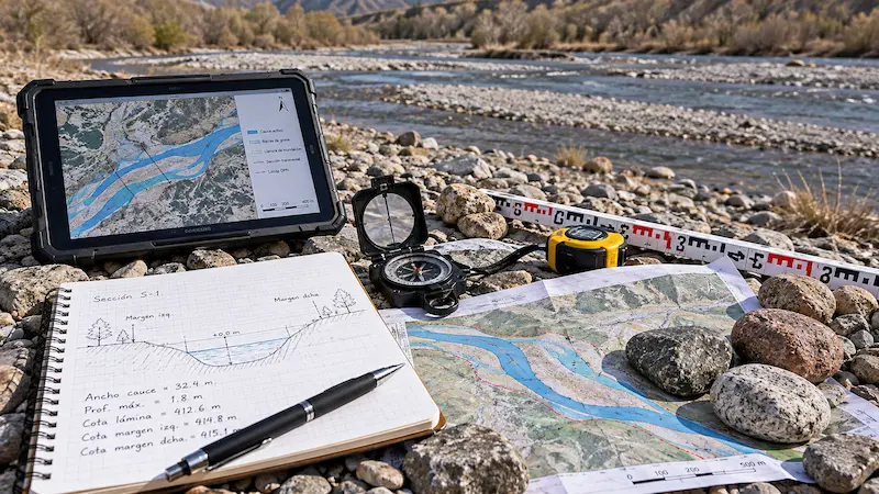
Surveying and analysis of the channel's shape, banks, width, elevations and physical characteristics within the assessed reach.
Sediment characterization
Description and assessment of the materials present, including their distribution and characteristics within the reach of interest.
Watercourse behavior
Analysis of physical and geomorphological conditions that help explain the watercourse's configuration and changes within the study area.
Surveying of the reach
Elevation and planimetric data to accurately represent the watercourse, its banks and areas associated with the application.
Mapping and GIS
Delineation of the reach, access routes, coordinates, thematic layers and other spatial information needed to technically document the project.
Environmental context
Integration of environmental and territorial features that must be considered in the applicable assessment and permitting process.
Not all reaches have the same geometry, materials or dynamics, so the technical scope must be defined individually for each project.
Surveying and mapping of the watercourse reach
The project's spatial delineation must be clear and consistent with the actual conditions of the watercourse, its banks, access routes and associated territorial features.
Survey of the reach and its banks
Survey data enable accurate representation of the watercourse's geometry, banks and areas directly associated with the project.
- Watercourse cross-sections and geometry.
- Banks and reference points.
- Elevation relationships along the reach.
Delineation and GIS support
Mapping integrates the location of the reach with access routes, coordinates, infrastructure and other territorial features needed for the project's technical documentation.
- Spatial delineation of the reach.
- Coordinates and territorial reference data.
- Access routes, roads and surrounding features.
Environmental Approval is part of the concession process
Once the Temporary Area Reservation has been accepted, the procedure continues with environmental assessment before SETENA. Environmental Approval is among the requirements for subsequently formalizing the concession application before the DGM.
Accepted Temporary Reservation
The application advances once the reservation is accepted under the applicable procedure.
SETENA assessment
The project proceeds through environmental assessment using the instrument applicable before SETENA.
DGM formalization
With the corresponding Environmental Approval, the concession application may proceed to formalization before the DGM.
The DGM and SETENA act at different stages of the same project
Environmental Approval does not replace a mining concession, and the DGM concession procedure does not replace environmental assessment. Each authority acts within its own jurisdiction.
How does a watercourse extraction concession proceed?
The concession follows a technical, environmental and administrative sequence. Formalization before the DGM takes place after preliminary stages involving area reservation and Environmental Approval.
Temporary Reservation
The reach of interest enters the administrative process through the applicable Temporary Area Reservation.
Institutional verifications
During this stage, specific consultations and checks may be undertaken concerning the requested reach and the competent institutions.
Environmental assessment
Once the reservation is accepted, the project proceeds with SETENA environmental assessment until the corresponding Environmental Approval is obtained.
Formalization before the DGM
The concession application is formalized with the technical, environmental and administrative documentation required for the project.
Technical review and inspection
The DGM reviews the studies, plans and other technical information and may inspect the reach or request clarification as appropriate.
Administrative proceedings
The file continues through publication, administrative actions and other procedural stages required by the applicable regulations.
DGM recommendation and Executive Branch resolution
Upon satisfactory completion of the review, the DGM issues its corresponding recommendation. The granting resolution is issued through the Executive Branch procedure.
Granting does not end all obligations: the concession remains subject to the applicable conditions, registration, operations, monitoring and other requirements.
Submitting an application does not automatically mean the concession will be granted.
We start with the actual watercourse before defining the application file
Each reach has different conditions. We therefore review the site and available information before specifying studies, surveys or technical documents.
Initial review of the reach
We identify the location, access, previous records, general watercourse characteristics and current status of the procedure.
Technical assessment
We review geometry, materials, surveying, mapping, territorial context and the environmental components associated with the project.
Preparation of technical inputs
We prepare or supplement studies, plans, maps, spatial files and technical documentation according to the requirements defined for the procedure.
Technical support for the case file
When the procedure requires clarifications, changes or further information within the contracted scope, we assist in reviewing and preparing the necessary technical inputs to move forward.
Common questions about concessions in public-domain watercourses
This category has its own technical, environmental and administrative conditions. These answers help distinguish watercourse mining concessions from other permits and resource uses.
Is a watercourse concession the same as an ordinary extraction concession?
No. Although both are governed by mining regulations, material extraction from public-domain watercourses has specific conditions, studies and requirements related to the reach where the activity is proposed.
Does a mining concession in a watercourse replace a permit for works in watercourses?
No. These are different legal instruments under different authorities. The DGM concession regulates mining use; if the project includes works governed by the Water Directorate, these must be evaluated separately.
View permits for works in watercoursesHow long may the reach covered by a concession be?
The applicable regulations establish a maximum length of two continuous linear kilometers per concession, covering the width of the watercourse under the regulatory criteria.
For how many years may a watercourse concession be granted?
The current regime provides for a maximum initial term of ten years. This is a legal limit, not a guarantee that every concession will be granted for that term.
Does owning property next to a river give me the right to extract materials?
No. Ownership of adjacent land does not replace the concession required to extract materials within a public-domain watercourse.
Does a watercourse concession require Environmental Approval?
Yes. Once the Temporary Area Reservation is accepted, the procedure continues with environmental assessment before SETENA. Environmental Approval is part of the process before formalizing the application with the DGM.
Is a watercourse concession the same as artisanal mining?
No. The watercourse extraction concession described here and artisanal mining categories are governed by different procedures and conditions.
What technical information may be required?
Depending on the project, information may be needed on surveying, watercourse geometry, materials, mapping, coordinates, access routes and other technical or environmental components.
Can Geo Costa Rica prepare mapping and studies for the reach?
Yes. We can support surveys, mapping, GIS analysis, technical characterization and preparation of inputs defined for each project.
Can you review a concession application already in progress?
Yes. We can review available studies, plans, mapping, requirements and records to identify gaps and assist with additional technical documentation.
We review the reach and the procedural steps before defining the studies
We can assess the location, previous records, watercourse characteristics, mapping, surveying, materials and current application status to identify the technical, environmental and administrative steps your project requires.