



Geophysical Surveys
At Geo Costa Rica, we conduct geophysical surveys to investigate physical variations and contrasts within the subsurface, turning these measurements into useful information for geological, geotechnical and hydrogeological studies.
Gather information where direct observation is not possible
Geophysical methods measure certain physical properties of the ground from the surface and analyze how they vary laterally and with depth.
How does the subsurface change between the points we can observe?
A borehole provides direct information about what exists at a specific location. Geophysics can help extend that interpretation and identify contrasts along a survey line or across an investigation area.
These contrasts may be associated with changes in materials, boundaries, fractures, saturation conditions or other features that must be interpreted in their geological context.
We measure physical variations to identify contrasts within the ground
Each method responds to a different physical property. The goal is to select the method that can provide information about the conditions the project needs to investigate.
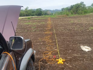
The method is selected based on what we need to understand
A geophysical anomaly does not automatically identify a material. Its meaning must be established through interpretation and comparison with available site information.
Different questions require different geophysical methods
Study design depends on the objective, ground conditions, depth of interest and the physical property most useful for investigating the problem.
Electrical resistivity and tomography
These methods measure changes in subsurface resistivity and produce profiles that can reveal lateral and depth-related contrasts.
- Electrical resistivity tomography.
- Vertical electrical soundings when justified by the study objective.
- Investigation of subsurface boundaries and resistivity anomalies.
- Geological, geotechnical and hydrogeological applications.
Wave propagation through the ground
Seismic techniques analyze wave velocities and behavior to investigate mechanical properties and contrasts within the subsurface.
Depending on the objective, seismic refraction or other surface-wave methods may be used.
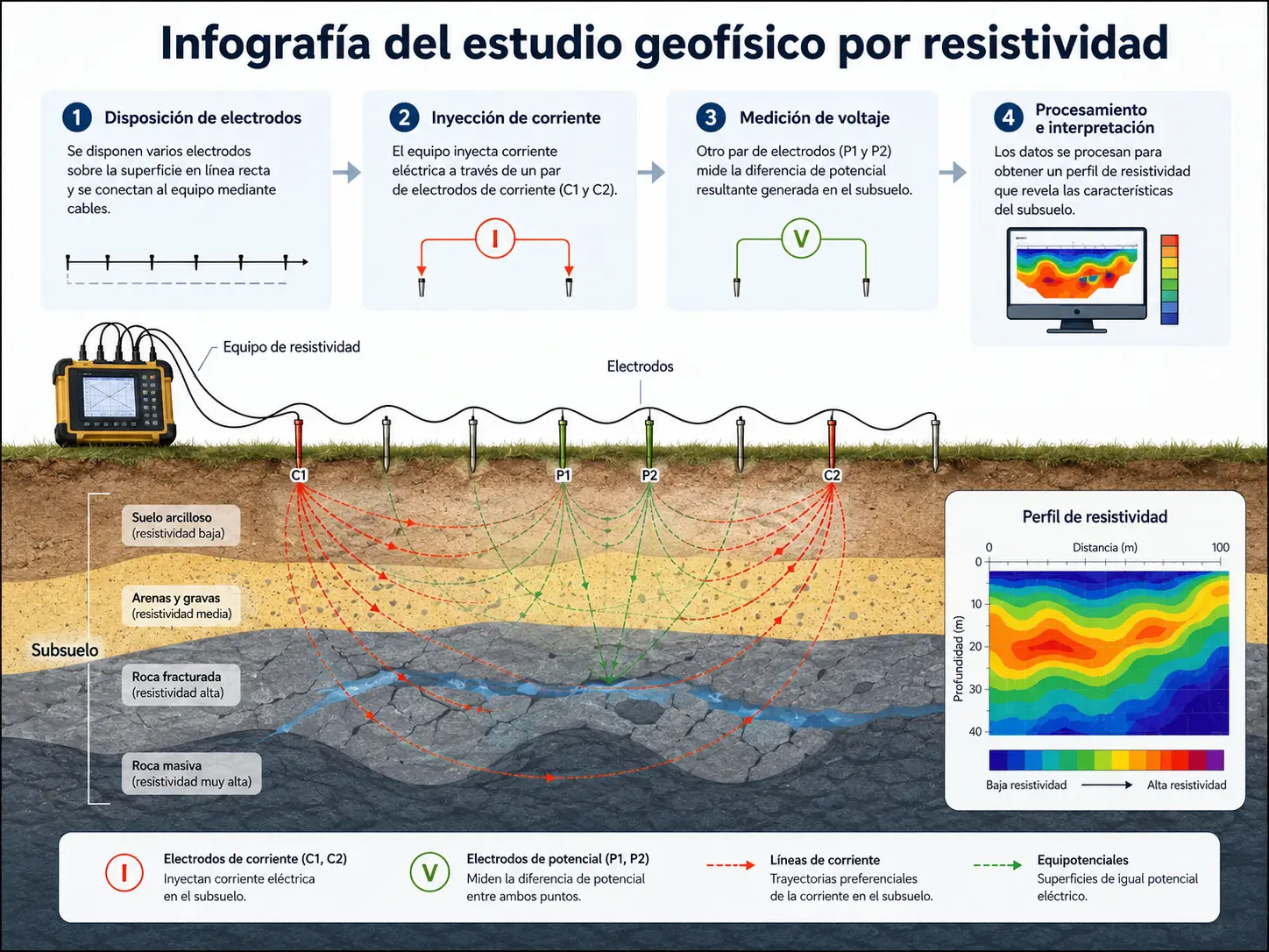
Design
We define the method, survey geometry and profile locations according to the technical question.
Measure
We acquire geophysical data directly in the field.
Process
We organize and model the measurements obtained during the survey.
Interpret
We relate the physical contrasts to the geology and the study objective.
Turn measurements into an interpretable picture of the subsurface
Processing shows how a physical property varies within the ground. Geological interpretation turns that model into useful information for the project.
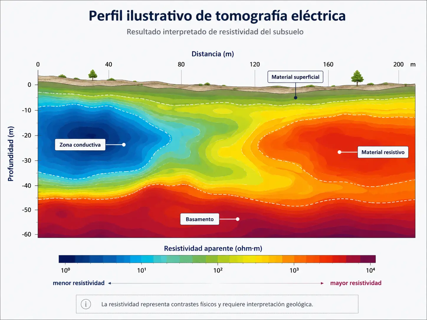
Contrasts help reveal how the subsurface varies
The results reveal zones with different responses and allow us to assess their geometry, continuity and relationship to depth.
A color-coded profile requires geological interpretation
A zone of low or high resistivity does not automatically indicate a particular soil or rock type, or the presence of water. At Geo Costa Rica, we compare the results with site geology, field observations and other available information before drawing conclusions.
When can a geophysical survey add value?
Geophysics is especially useful when we need to expand our spatial understanding of the subsurface or decide where further investigation would be most informative.
Geophysics and direct exploration answer different questions
Geophysics identifies spatial contrasts indirectly. Boreholes and direct tests establish which materials are present at specific points. Together, these methods can improve subsurface interpretation.
Common questions about geophysical surveys
Does geophysics replace drilling?
Not necessarily. Geophysics investigates subsurface contrasts indirectly, while drilling allows direct observation of materials at a specific location. The two methods can complement each other.
Which geophysical method does my project need?
It depends on the conditions being investigated, the physical property that can help characterize those conditions, the depth of interest and site characteristics.
How deep can the investigation reach?
Investigation depth depends on the method, acquisition geometry, sensor spacing, ground conditions and the quality of the data collected.
How much does a geophysical survey cost?
Cost depends on the method, number and length of profiles, investigation objectives, depth of interest, location and site access conditions.
Investigate the subsurface beyond the points you can observe
Geo Costa Rica provides geophysical surveys for geological, geotechnical and hydrogeological investigations in Costa Rica, combining field measurements with technical interpretation of ground conditions.