



Project Georeferencing
We locate, delineate and spatially structure projects, properties and features of interest so they can be consistently integrated into maps, technical studies, geographic information systems and regulatory submissions.
Correctly locating a project within its geographic setting
Georeferencing means linking project information to a defined location and geometry within a coordinate system, allowing it to align accurately with maps, databases and other geographic layers.
Where is it?
We establish coordinates and a reference system to locate the project correctly.
What shape does it have?
We structure points, lines and polygons according to the feature being represented.
What is it related to?
The location then allows the project to be integrated with infrastructure, hydrography, terrain, restrictions and other geographic variables.
Each feature needs an appropriate spatial representation
Geometry is defined by what needs to be represented: a point location, a linear feature, a property, an intervention area or a combination of components.
Locations
Wells, springs, structures, access points, stations, sampling sites and other point features.
Linear features
Roads, pipelines, watercourses, trails, linear works and other features represented by their centerlines.
Areas and surfaces
Properties, project areas, intervention zones, land-cover areas and other delineated surfaces.
Set of geometries
We integrate different layers to represent the relevant components of a project spatially.
The same location must work throughout the project
Many mapping problems arise when drawings, coordinates, GIS files and technical studies represent the same project in different ways.
A GIS layer needs more than geometry
We review coordinate systems, projections, geometries, attributes and file structure so information can be properly integrated with other geographic sources.
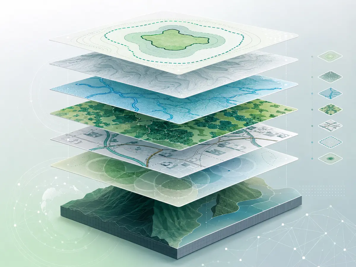
We prepare data to work together
- Review of the source coordinate system.
- Transformation to the required system when appropriate.
- Use of CRTM05 or the current official system, depending on the intended purpose.
- Validation of position and geometry.
- Organization of fields and attributes.
- Consistency checks across different layers.
- Conversion of information from historical coordinate systems.
- Preparation of files for GIS, mapping or regulatory procedures.
We deliver information prepared for its intended purpose
The final format is determined by the project's objective, the platform on which it will be used and the requirements of the receiving institution or professional.
Shapefile
Vector layers with geometries, attributes and a defined reference system.
KML / KMZ
Files for visualization and exchange on compatible geographic platforms.
Maps
Graphic representation of the project and relevant geographic features.
Coordinates and tables
Structured lists of points, vertices or other features when included in the scope.
Georeferencing for SETENA submissions
Geospatial information forms part of the geographic representation of projects undergoing environmental assessment and must be consistent with the other elements of the submission.
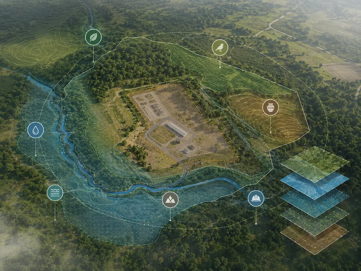

Geospatial information for the Project Area
Depending on the submission, mapping information may include different geometries associated with the property, infrastructure and Project Area.
- Property boundaries or the survey plan used as reference.
- Points associated with the Project Area.
- Linear project features.
- Project Area polygon.
- Area of Influence when required for the EIA.
- Files with the required coordinate system and structure.
A common spatial base connects different studies
Georeferencing enables different environmental disciplines to work from the same geographic representation of the project.
Environmental Impact Assessment
Allows the Project Area, Area of Influence, receptors and environmental components to be related within a single analysis.
Environmental Management Plan
Allows measures, sensitive areas, monitoring locations and environmental actions to be mapped where appropriate.
Mapping and Spatial Analysis
Once the information has been correctly located, we can analyze spatial relationships, restrictions and geographic patterns.
Georeferencing, surveying and analyzing are not exactly the same
Mapping services may complement one another, but each answers a different question within a project.
Where is it and how is it represented?
Defines the position, geometry and spatial reference of information used by the project.
What exists on the ground, and where?
Collects information directly in the field to create inventories or georeferenced layers.
What can we learn from the relationships?
Analyzes distances, overlays, patterns, restrictions and relationships between geographic variables.
From available information to a consistent geographic database
We receive the information
We review available plans, coordinates, files, sketches and background materials.
We identify the reference system
We determine coordinate systems, data sources and any transformations that may be needed.
We build the geometries
We structure points, lines or polygons according to the scope.
We standardize
We organize attributes, projections and file structures.
We validate
We check positions, overlays and consistency between layers.
We deliver
We prepare the files and mapping deliverables defined for the project.
Spatial information ready to integrate into the project
Before georeferencing a project
What information does Geo Costa Rica need?
We can start with the project's location and any available plans, GIS files, coordinates, sketches, designs or background information.
Can you work with information in different coordinate systems?
Yes. We first identify the original coordinate system correctly and then assess the transformation needed for the intended use.
Does georeferencing replace a topographic survey?
No. Georeferencing locates and structures information within a spatial system. When specific topographic accuracy, field surveying or work legally reserved for licensed land surveyors is required, the appropriate method and qualified professional must be used.
Does georeferencing a survey plan legally change its property boundaries?
No. We can spatially represent the information provided, but the legal definition of property boundaries and land-surveying activities fall within the remit of the duly qualified professional.
What file formats do you deliver?
It depends on the objective. We can work with GIS formats, KML/KMZ, maps and coordinate tables to suit the project's needs.
Can you prepare geospatial files for SETENA?
Yes. We can structure the mapping information required within our technical scope for integration into the corresponding environmental submission.
Need to organize or georeference your project's information?
We can review available plans, coordinates and files to determine the most suitable way to structure spatial information and prepare the necessary deliverables.
Let's review your information
Send us the location, plans, coordinates or available files, and tell us how you intend to use them.